Monday, August 28, 2017

A Far Piece From Home - Travelogue 2017v10: Everybody In! Family Reunion

Click to play this Smilebox slideshow
Create your own slideshow - Powered by Smilebox
Free slideshow design generated with Smilebox

We were now truly a far piece from home, but in a way it was kind of like being back home.  We were in Anacortes, Washington for the Cook Family reunion, Sue and 5 of her brothers and sisters all gathered for excursions and dining and catching up with one another.  The gathering was thrown together by Brother Bob's wife Anne, who lives up there on the edge of Washington.  After months of asking, "Hey, when is everybody going to come out here?"  

Sue always maintained that she was the odd one out in a family of planners and organizers, not her strong suit.  But then again, nobody seemed to be able to get too organized or make any plans, surprising, but true.  It did come together, and maybe not surprising, it was a good time on the saltwater shore and under the 'proper kind of forest' as brother Tom observed.

It was a time of ambling and rambling with no hard driving purpose, but just a chance to get together and go see some of the stuff around the Skagit County.  There was a trip to Samish Island beach for picking up sealife in tide pools, a picnic at Padilla Bay and a walk through the proper kind of spruce forest followed by a big family dinner.  Bill, the one who did not make it out for the grand gathering, sent along some home canned sweet pickles for communal consumption.  We hoisted a gherkin in his name and wished he were here.

There was a ferry trip to Friday Harbor on San Juan Island, pretty much because a lot of folks in the group think it fun to sail through the islands on a ferry boat.  Those in the group that did not share such a concept of what constituted 'fun', sailed along with the crowd to go along anyway, what the hey?.  We wandered on foot through the tourist trapping boutiques and shops in town, stopping to get some beer and food for lunch.  There ferry scheduled was pretty far out of kilter once were ready to return to the mainland, so with the delay, what could we do but order some ice cream?  Lavender ice cream was highly advertised and recommended by some, though not everybody shared the same taste nor did they share licks.  Family will only take you so far, but there comes a point where you have truly crossed the line.

For Sue and me, it had been a long and wonder-filled road trip, but it was time to turn it around and drive hell bent for leather back to Texas.  Likewise, Tom and Esther had a few stops to make besides the reunion, so they left town a bit before us.  Mike and Sally opted to linger a bit longer and Bob promised to take out his boat and crab pots to get a fresh dinner from the bottom of the channel.  It was a good plan, until the boat motor blew a head gasket and quit in the middle of the deep blue sea.  They were rescued and had plenty of juicy pincher critters to throw in the pot once they did get ashore.

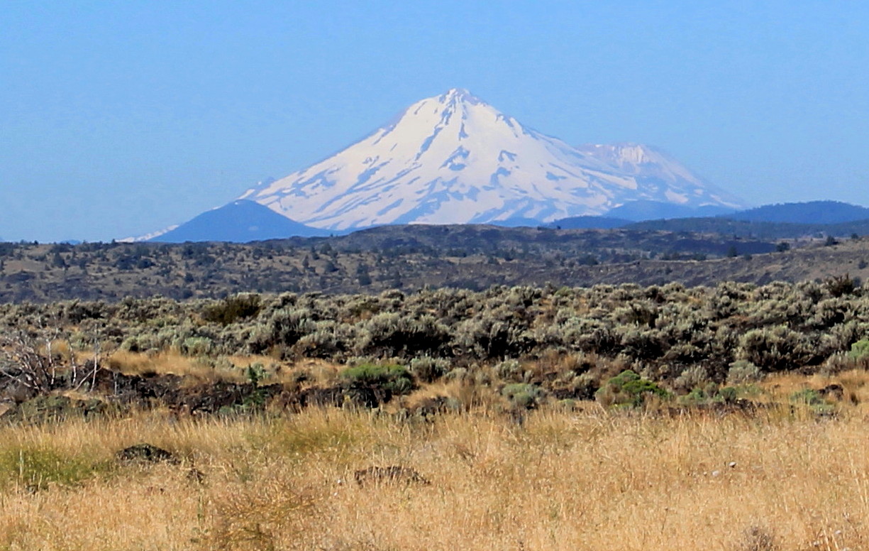
For us it was drive to my parents house in Polson, Montana, where we claimed a good late meal, some homemade dessert and a free bed.  Thanks Mom & Dad, we gotta go now! Off early the next morning for the long 13+ hour haul to Denver.  A friend from our days in Denver in the 1980's was allowing us to sleep at her place, even though she was going to be out of town.  Another kind and good plan, except the code to get into the garage and into her place did not work.  There are planners and thinkers-aheaders in this world, and Cindy being one, also had directed us toward a neighbor with a key if we ran into trouble.  We got the kindly neighbor to put on her bathrobe and open the door and provide a key to Cindy's place.  Aaah, we slept well.

A long breakfast with old friend Walt in the morning before we left town.  Walt, a former commercial lumber salesman is now a Presbyterian Minister with a church on the plains east of Denver.  Walt seems pleased with what the Lord has done for him.

We loose an hour traveling east, but the end is in sight, and we returned to our home to find the A/C still working (I had my doubts as I locked the door behind me 19 days ago) and our bed ready and willing to accept us back into it comforting folds.

A far piece from... and a far piece back to home.  But did we travel well and see some great people and sights.  I'd have to admit, I did enjoy the journey.

Some of the stats:

Trip Mileage: 5,804 Miles
Fuel: $726.43 Cost of Gasoline, 290.6 Gallons
Average 19.7 MPG
Average Fuel Cost: $2.499


A Far Piece From Home - Travelogue 2017v9: Crater Lake

Staying with a winning theme, it was going to be another day of volcanoes.  Or more like one volcano, but a spectacular one at that - Crater Lake Volcanic National Park.  This place is a big mountain, but it used to be much taller until the peaks that formed the top blew off of old Mount Mazama in a massive explosion about 7,700 years ago.  Now it is a big mountain with a bowl on top, the eponymous Crater Lake, filled with pristine rain water and snow melt to a depth of about 2,150 feet, the deepest in North America.  And to think this deep lake is on top of a mountain.

Me and Grant in June, 2013
Our view of Crater Lake is shown over our sholders
Sue, a native of the Northwest and volcanologist with an advanced degree, had yet to have a chance to see this brilliant blue liquid jewel.  I was determined to make it happen for her today.  I glanced at the sky as we ascended the road up the side of the volcano, and noted it was a clear day, unlike 4 years ago when I veered off the scheduled route to take my son to see this memorable sight.  Only in June of 2013 we ascended the slopes of old Mt. Mazama only to drive up into clouds that began to snow on us.  The clouds that day sat low and cold and pregnant with snow.  Those clouds turned the road that wound around the rim of the crater into an icy death-defying skate and of course completely obscured any view of the lake far below.  It was a wonderful cloud viewing day for Grant and me for our $20 entrance fee back in 2013.  But this day for Sue and me, it did not disappoint. 
This was our summer view of Crater Lake in 2013

Panorama of Crater Lake and Wizard Island (cinder cone) behind us


Snow drifts still on the shoreline of Crater lake in July, 2017


The steep sides of the interior crater,
rangers hate to have to go retrieve people who fall over the edge
of these unstable slope - and they have signs saying as much.
With our eyeballs filled with blue, high altitude sky and even richer blue 2,000 foot deep waters, we coasted back down the side of the mountain and angled northwest over the spine of the Cascade Range and on into Portland to spend a few days with Inga and Sean.

It was good to catch up with the "kids" and tour some of the charming eccentricities of their neighborhood, just off of Alberta Street.  We dined on Persian food in a converted auto repair garage and then stopped into a tea shop.  The ladies love to explore exotic teas in this market.

Inga & Sue shop for exotic teas on Alberta Street


I'd also made plans to visit a couple of cousins while in Portland, and cousin Warren and his wife Cherie, settled on meeting us at a tasty seafood establishment in their neighborhood.  Cousin Carolyn and Michael joined us a bit later after they finished up at a tea market convention, where Carolyn was showing her wares in her newly founded Tissiack Tea Company.  It was a brief catch up time with some good, fun and always interesting relations, an experience I treasured.


Sunesons join cousins Carolyn and Warren for a dinner and a chat
while in Portland


A Far Piece from Home - Travelogue 2017v8: Modoc Indian Culture at Lava Beds

Loop Trail around Captain Jack's Stronghold
Lava Beds National Monument
Our Day 3 at Lava Beds was our exit day on the way up to stay a couple days with Inga and Sean in Portland.  Before I left Lava Beds National Monument, there was some historical and pre-historical places to visit inside the Monument.  The first place we went to that morning was "Captain Jack's Stronghold"; a place where in 1872-73 about 60 Modoc warriors held off the much larger US Army command that was looking to either negotiate or force Captain Jack and his band back onto the Klamath Indian Reservation (a group the Modoc considered enemies).  Though there was a groundswell of support by the local European settlers to accommodate the Modoc and their claims, a series of blunders and miscalculations on both sides led to a conflict that sealed the fate of the Modoc.  General Canby led a negotiating party that met with Captain Jack and several warriors, only to be surprised by treachery by the Modoc and killed in an ambush.  General Canby's death is significant as it is the only time in US history where the commanding general was killed in the conflict.  After Canby's killing, more troops and artillery led to the Modoc's capture; Captain Jack was hanged and most of the Modoc were shipped off to Indian Territory (now Oklahoma).  Being interested in this part of the only Indian War in California, I'd checked out a book on this sad affair in 8th grade, and had wanted to see the place myself someday.
Mount Shasta in the distance, natural fortifications used by Modoc warriors in the foreground

We parked at the head of the interpretive loop trail that wound around the roughed terrain of volcanic rock, caves, crevices and other elements of natural fortification.  At the time, Tule Lake, now much diminished by irrigation water use, lapped to the edge of the stronghold.  Once the US soldiers cut off the Modoc from their access to water, the conflict was over.  We soberly strode across the terrain on this bright morning, and as is the case with most all the battlefields I've visited, it is difficult to truly imagine the suffering and pain that was once associated with this hallowed ground.


Sheltering cliff face used to hold off a superior US Army force


Spontaneous Memorial to Captain Jack and the Modoc
raised inside of the stronghold. 
Numerous trinkets, coins, ID cards
and other personal items left in the high desert


Before we crossed into Oregon to visit Crater Lake National Park, we had one last stop to make at the edge of the Monument.  We were going to see Petroglyph Point, a butte made of layered volcanic ejecta, including a basal layer of volcanic ash that has been inscribed with numerous enigmatic glyphs by the early Modoc people, perhaps as far back as 6,000 years.  Petroglyph Point was once accessed only by boat as it has been surrounded by Tule Lake through most of its existence, but the lake is smaller now and we can drive right up to the cliff face and see what humans hands had carved between 1,500 and 6,000 years before us.


Petroglyph Point
A volcanic vent that erupted through Tule Lake thousands of years ago,
provided a soft layer of volcanic ash into which the
Ancestral Modoc Peoples carved enigmatic (to us) markings and patterns 
Abundant markings that to me signify perhaps rivers, mountains and trees

Glyphs etched into volcanic ash that settled into the ancient Tule Lake

A Far Piece From Home - Travelogue 2017v8: Volcanoes & Caves at Lava Beds

This was a day of lateral movement, a west to east transect across northern California that brought us into and out of contrasting landscapes.  The morning began in the cool marine air and light fog under the towering forests at Patrick Point, where we shared space on the forest floor with fern and banana slugs.  We backtracked down Highway 101 through redwoods with their tops veiled in wisps of fog and then cut east over the Coast Range where it was noticeably more arid once we crossed the summit and cruised down the eastern slope.  Traffic picked up in Whiskeytown, a gold rush community turned vacation get-away development.  As we were coming into Redding at the northern end of the Sacramento Valley I pointed out that this was likely our best shot at lunch, and as we were about to engage in a rock-paper-scissors contest to decide burger-taco-chicken, we passed a Mediterranean Restaurant.  U-turn.  Rules say kabob trumps all.  Most of the traffic goes north-south through Redding on I-5, we were going east unlike the madding crowd - just the way a contrarian likes to do it.

Quickly pulling out of the Great Sacramento Valley, we were in the red-soil, volcanic province of the Cascade Range, home to stratovolcanoes Mount Shasta and Mount Lassen.  These are massive giants that live in the sky with power and strength to cast ash out to the middle of the continent and launch rocks nearly into space, cool the planet with a pall of dust and shake mortals into reverence with columns of fire and plumes of smoke.  For now they sleep, but Dr. Mack always told us in Geol 401; "Scholars, mark my words, one of these big guys is going to blow in your lifetime!"  [Dr. Mack's prophecy of 1976 was proven correct with Mt. St. Helens in 1980].  After an afternoon of driving across vast tracks of range land with seldom another vehicle among the cattle, pines and rugged volcanic rocks, we settled in at Lava Beds National Monument in the high desert of sage and lava.


Mount Shasta Cascade Volcano
From Captain jack's Stronghold
Lava Beds National Monument

For me, Lava Beds was a 'must see before I expire' kind of a place.  I scheduled a two day holdover here, with lava tube caves to explore, historical setting from the US-Modoc Indian war in 1873, a campfire under the most brilliant starry skies either of us had ever experienced and a great place for a little kick-around for any impromptu adventures that presented themselves, and for help with the latter, I brought along my own personal favorite igneous geologist (my wife).

Lava Beds National Monument is remote.  The Oregon border is in view from the knoll on which we camped and not many folks know of or make it out to this place.  I think I may have found my place in California that has not yet been ruined and all shot to hell with crowds.  Somehow, the Europeans have found the place though, we camped next to several Germans our first night, and after they vacated the camp, a rental RV with Danes pulled in.  I was told by the campground host that the French were nearby.  Amazing, go figure, eh?

There are 25 marked caves in the area formed as magma was extruded across the landscape a mere 30,000-40,000 years ago, as the magma cooled and formed a rock crust on the surface, the molten rock continued to flow beneath the crust, forming tubes that conducted the magma down hill, and leaving behind hollow tubes inside the lava flows.  Once the surface of the tube weathers and collapses, one can enter and explore these lava tube caves.  It is recommended that one carry multiple flashlights, a bump helmet and gloves and knee pads to explore the inner recesses.  I'd done my homework and had all of the above and we were ready for some spelunking. However, once the mama bats select a cave for their rookeries, the public is then kept out in deference to the baby bats.  That eliminated some of our choices for exploration targets.

We started the bright morning at the visitors center where we needed to get certified that were were not vectors of the 'White Nose Syndrome', a fungal infection that has been decimating the bat population in the US.  Once we submitted to questioning by the ranger that neither our boots, clothing or equipment had been in a cave or mine in the last 10 years, we got a "Uncontaminated Status" display card for the vehicle window.  We signed up for an afternoon ranger-guided tour of Sunlight Cave, but we were also intrigued by a rumor of Glass Mountain some 20 miles off of the National Monument property.


The Q parked at the toe of the
rhyolite flow from Glass Mountain
Bands of obsidian layered within
pumice and rhyolite
Indeed, we got pretty excited about locating Glass Mountain, a rhyolite extrusive event from only 900 years ago - a relative fraction of a second in goelogic time reckoning.  The ranger produced a photocopied hand-drawn map that showed forking dirt roads in an over-the-hill and through-the-forest kind of route, cautioning us that we may still encounter snow on the road (this is July).  I threw The Q into 4-Wheel Drive and we were off on our first impromptu adventure.  


The Forest Service Road took us to the toe of silica-rich flow that had been halted in its advance by a hillside.  We parked and rushed out of The Q to take a good look.  There were bands of obsidian layered with frothy pumice stone, and all manner of spectacular volcanic textures rarely seen, owning to the very recent activity here.  We were almost to the point of squealing with excitement, but managed to keep it to constantly calling to one another, "Hey come over here! Tell what you think this is?" 

I made the difficult scramble to the middle of a pile of crumpled blocks of obsidian and sat quietly for a moment in the breeze, and I could hear the slight glassy tinkle and the distinct sound of chipping of glass as this unstable pile shifted in the summer breeze ever so slightly.  But it was musical to hear these rocks sing to me as sat in admiration of this sight born of violent upheaval.


Recumbent fold of obsidian and pumice.
So many fascinating volcanic textures and features
displayed at Glass Mountain


We were back at camp for lunch and a chance to re-hydrate.  We checked our caving gear and headed out for our tour of Sunlight Cave.  We were introduced to 'dripstone' or 'lavacicles' formed by magma as it dripped off the cave ceiling and then cooled into a stone texture resembling icicles. We managed to explore five caves that afternoon, each with some unique features.  Golden Dome Cave was especially interesting with its high ceilings seemingly spattered with metallic gold paint, but the spectacular shiny gold ceiling surfaces are formed by actinomycetes bacteria, which is hydrophobic (i.e. causes water to bead up in its surface).  These were some of the many underground wonders that never see the light of day, but with a flashlight and helmet we were truly treated to inspiring beauty.


Dripstone or 'lavacicles'
Stone formed by molten lava dripping from the ceiling
pf a lava tube

Exploring Golden Dome Cave


Golden Dome Cave
actinomycetes bacteria make a the ceiling of this cave
sparkle gold among the dripstone

With the sun down, and our limbs mildly soar from the ducking, stooping and hiking around the lava beds and tubes, we sat mostly silent as the campfire died down to a few embers and as we tossed our heads back, the starfield above us was yet another spectacular dome of brilliant stars, the likes of which I have never experienced. 


Click to play this Smilebox slideshow
Create your own slideshow - Powered by Smilebox
Make your own free slideshow


Sunday, August 27, 2017

A Far Piece From Home - Travelogue 2017v7: Burney Falls & Magic Memories

Some daybreak rays of sunlight managed to find its way over the range and filter its way down and under the giant conifer limbs overhead.  We somewhat reluctantly threw back the top layer of our bedding and reached across the domed tent space to retrieve some suitably cozy clothing in which to eat a simple breakfast this bright and cool July morning.  We threw ourselves into repacking the equipment and pulling up the stakes and stowed it all in The Q, now ready for more adventure.

Patrick Point was a second (or way is a fourth?) choice destination, but a pleasant surprise.  My next chosen destination was to be just a stop along the way, but one stop I'd been eager to make for awhile.  My plotted course brought us by another place of vivid and magical memories from my youth in 1963.  


Bifurcated Burney Falls
A Magical Place from my
Early Memories


Burney Falls, tucked up toward the little known northeast corner of California, holds a very special place in my heart and memories.  Dad worked for Pacific Gas & Electric (PG&E), a large utility company, which owned a camp at the edge of MacArthur-Burney Falls State Park, that was available to PG&E employees.  In 1963, Dad had made reservations for the family to have a vacation at the camp, but mom had just had an emergency appendectomy and new baby Sheri, it was decided, would be left in the care of friends back home.  I do not remember traveling in the car to this place, but I do recall the car entering the camp where a long barracks building with individual family cabins sat high up on stilts next to the lake.  We stopped to check in with the caretaker, and 6-year old me and 4-year old sister Wendy got out of the car and were immediately threatened and accosted by a flock ornery geese with sharp pecking beaks on a serpentine neck that rose to the level of my vulnerable throat.  Yikes! Help! They're after us!! We screamed and ran back to the car.  The grownups did not seem to take this as seriously as I believed they should have. Fortunately the patrolling gestapo geese did not follow our car as we parked at the very far end of the building and climbed the steps up to the elevated cabin.  Mom let us have some Craigmont Soda (Safeway store brand - a better bargain than a name brand), from dazzling colored aluminium cans, a beautiful deep purple can that poured forth grape soda, as I recall.  This was a wonder and a treat.

Between our cabin and the hillside behind it was a swing set and a slide.  Wendy and I were encouraged to go and play while the parents worked inside.  We were pretty content to swing and slide and do a bit of close-by gawking at our vacation surroundings when a big kid, an authoritative girl came over to make our acquaintance.  She soon began to spin an ominous tale. We were warned that big bears, ferocious bears, will come out of those woods right there as she point directly behind the swing set on which we were formerly enjoying our play time.  "And you know what?", she continued, "those bears come out of the woods 'cause they're hungry!"  Recovering from the recent trauma of geese was going OK up until that point when we met this 'big girl'.  Geese could hurt you, but being ripped to tatters by hungry bears lurking right behind that tree was an even more serious danger.  Yikes! Help!  The bears are coming!! Help! We're about to be eaten by the bears!  

We ran across the play yard and bounded up the steps for safety inside the cabin with our parents.  I reached for the door, but it had been locked.  Locked as parents of young kids are at times want to do.  Locked at this critical time when me and my sister's very life hung in the balance.  We screamed for a long time on the stoop, and once again it seemed that the grownups were not taking this as seriously as they should.  Finally, the door was allowed to be opened as we rushed in to explain our escape from great danger.  I like to think that I sidled up to the little kitchen counter and threw back another purple can of Craigmont soda to calm my nerves.

Afterwards, the geese continued to threaten me and my sister, but the bears never did materialize.  New wonders and fantastic sights of the natural world were appearing before me at every hour.  There was a crystal clear blue pool where Burney Creek entered the lake next to our cabin.  I could peer into the azure depths and see large trout swimming about.  I tried to catch fish that vacation, but only managed to get my line hopelessly tangled.  I saw a ribbon snake, and I was very much a 6-year old expert on reptiles, especially snakes for which I was thrilled to encounter.  I learned of horsetail plants growing along the creek bank and that these plants were found in fossils going back 240 million years!  Along the trail from PG&E's camp to Burney Falls were out crops of a chalky white earth, only it was not chalk (CaCO3) but rather diatomaceous earth.  A deposit made of billions upon billions of tiny silica tests from single-celled creatures that had drifted and collect on an ancient seafloor.  Along the shore of the lake were vesicle-riddled pumice stones, which another camper and I discovered we could make these pieces of pumice rock actually float on the water, at least for a few moments.  Wow! Floating rocks! There was so much wonder and thrilling knowledge for a young scientist at every turn.  Perhaps my calling as a geologist began here at Burney Falls in 1963.  I do not doubt that this place is a pivot point in my life, awakening dreams and interests that resonate in me to this day.


Back to a place of pivotal memories
Burney Falls  


I was excited to pay our $8 entry fee for a day pass to enter the state park.  It was warm as we stepped out of The Q and Sue paused to change into some hiking shoes.  I could hear the falls from the parking lot.  I'd initially hoped to walk the 1.5 mile round trip trail from the falls to the PG&E camp and back; but inside I also feared, as is inevitably the case, I would find the strong magic of my early memories to be no match for what my mature eyes would see, thereby destroying the residue of all of that early wonder left inside my mind.  Sue encouraged me to make the walk back along the creek if I wanted too.  I made it maybe a hundred yards down stream, and whether I was convince that we could not afford to lose the travel time needed to get a campsite at tonight's endpoint, or maybe I was convicted that I could not afford to lose the strong magic of my memories; either way, I turned around and said, "I've seen the falls.  I'm done here.  Let's go back."  I do not regret leaving some wonderful things from the past right there, in the past, where they will live and flourish for lack of a harsh ground reality.

We made it back to the parking lot unmolested by either ornery geese or hungry bears, I am pleased to report.


Burney Falls
Not California's highest waterfall - but in some ways
its most beautiful

Water drops 129' into a beautiful blue and green basin pool

Mist rises for the base of Burney Falls on a warm July afternoon


Many water rivulets pour out of porous volcanic rock


Saturday, August 26, 2017

A Far Piece From Home - Travelogue 2017v6: North Coast

Another day of easy travel, but a day that started with a hint of disappointment.  I had concluded, California has been ruined, ruined I tell you. All shot and gone to hell.  So many people crowded into the few good and special places.  Our family used to pack up and go camping on a lark some weekends.  To the coastal redwoods, state and national parks in the Sierras and Cascades.  Usually no problem finding a place to pitch the tent.  Not true any more.  The state has a camp reservation system, which makes planning easier and will eliminate the bitter disappointment of traveling far only to find a "Campground Full" sign posted at the ranger station.  Perhaps a necessary evil considering the crowded conditions and demand.  But a crimp in my care-free wilderness ranging spirit never-the-less.

To the point: for decades I had wanted to stay a night at Gold Beach State Park; a lovely and serene place to roll out my bag on the dunes at the edge of the redwood forest, listening to the surf roll ashore a stone's throw away, walking among the verdant draped vertical walls of Fern Canyon - another favorite locale and a memory spot from our honeymoon.  Gold Beach and Fern Canyon was my dream, my plan.  But it was all thwarted. One can make an online reservation for a campsite 3 months in advance.  It was a few weeks into April when I logged in to get a spot reserved in my name come July, that will be mid-week in July.  No sites available says the website.  This seems to be a case where people log on the instant they are eligible, crashing the site like they would for tickets to a Lady Gaga concert.  I tried for several days, hoping for a cancellation to leave me a space, no dice.  Time for the proverbial Plan B.  I checked on several other parks in the area, same result, everything filled up already.  Again I scoured the map for possibilities, maybe I could get something at Patrick Point State Park?  Lady luck coming through my ISP, Yes! Two sites available at Patrick Point.  I drew my credit card and quickly entered my numbers. Bingo! Confirmation for a spot at the Agate Beach Loop.

Leaving Mendocino mid-morning with the consolation of having a reservation, but joining the road that would take me close to... and then stop me short of my heart's desire, Gold Beach SP and the adjoining Fern Canyon.  Perhaps we could set up camp at Patrick Point and drive up to Fern Canyon in the late afternoon.  Alas, with the leisurely winding Highway 1 and summer-season repairs, it became apparent that it would be too much to get to Fern Canyon.  We will just have to enjoy a different part of the North Coast.

Exiting the interstate north of Eureka, we entered Patrick Pt. SP, and I immediately notice the yellow-lettered wooden sign, "Campground FULL".  I stopped at the entrance booth, "Ranger, we have reservations for Agate Loop site #22."  She checked off my name and we were waved on through.  The car in front of us had just been told that their was not room for them since they had no reservations; they might try some place else.  I could feel the frustration permeating out of that car's windows.  I shook my head and though, "Yep. The place is ruined, ruined I tell you. All shot to hell and overcrowded - sucks to be you."  


Agate Beach, Patrick Point State Park
Feeling crabby?
We're a good team.  The tent was soon popped up and anchored over the canvas ground tarp.  Camp food and anticipated clothing needed for a cool, damp night were properly arranged. 

Now, time to explore a new place.  We headed toward Agate Beach, and took the forested switch-backed trail over the edge of the cliff and down onto the pebbled beach where the sun was hanging not too far above the horizon.  We clambered around on tectonically scrunched rock faces and wiggled our toes in the agate sands.  Yet there was more to see.  We put our shoes back on and it was back up out of the clearly marked 'tsunami danger zone' to the top of the cliffs where we followed the Rim Trail over to Wedding Rock and Patrick Point.


Fractures and filled with quartz
Pleasing patterns on a cobble at Agate Beach


If the place was overcrowded with tourists and campers, it was all the more crowded with banana slugs feeding on fern fronds as the sun slipped lower in the sky.  We walked at a brisk pace in the cooling marine air to the precipice that was Wedding Rock.  A few more photos and then we scurried over to the large jagged outcrop that was Patrick Point.  This was the preferred place to be to watch the sun set, as we joined a handful of others all perched around and on top of the Patrick Pt.  Without much fanfare, the hues of orange and blue-gray faded to dusk and we stuck our chilled hands deep into our pockets and walked back to Site #22 to brush our teeth and sleep deeply under a dark forest among the dews and damps of the North Coast.  


Banana slug (Ariolimax sp.) hangs precariously from the tip of a sword fern while
out scavenging for its evening meal.
Banana Slug and the 'Sword Fern of Damocles'


A Banana Slug slips out along a fern frond
to dine on an evening meal


A beautiful end to the day at Patrick Point


It was not Gold Beach, but then again it was not a disappoint either.  I am thinking, "I am enjoying this journey of exploration with my mate", as I drift into peaceful slumber.

Click to play this Smilebox slideshow
Create your own slideshow - Powered by Smilebox
A free slideshow by Smilebox


This free digital slideshow customized with Smilebox

A Far Piece From Home - Travelogue 2017v5: Mendocino

With our taste buds still applauding us for our cheesy lunch selection, we left for one of our favorite romantic couple places, the picturesque coastal art town of Mendocino.  We stayed a night here on our honeymoon in 1986 and we enjoy getting back every decade or so.  Always good to be back when we do make it, and now it is customary for Sue to select a piece of jewelry as part of the Mendocino experience.  She really like this place ;-).

Click to play this Smilebox slideshow
Create your own slideshow - Powered by Smilebox
This slideshow generated with Smilebox


Mendocino, a favorite couples romantic destination


Window shopping
Trinkets and art in Mendocino


We stretched our legs with a slow walk up the barely surfaced streets of town with pauses to look through the shop windows at the art and trinkets on display in this artistic center hanging on at the edge of the world.   We kept walking on through town and found ourselves sauntering down some dusty trails and through waist-high wildflowers along a point of land atop the sea cliffs.  It is an eyeful to take in the scenic surroundings.  Gentle waves rise out of green waters and lap against the land, old working of unknown origins have had stout pilings carved into faces, my guest is the handiwork was done about 40 years ago when hippies were a new thing in the land.  We paused for a few moments to just watch the waters below, and then checked the time piece and decide we best be heading back to dress for dinner.


Carved piling from some old workings


We will return to Little River Inn, where we stayed as a honeymooning couple in April of 1986.  It is a nice to return to the memory and spot with a fine dinner at a small table for two, next to the garden window, as always.


Back for a 'Honeymoon Dinner'
Little River Inn


In the morning we purchased some food to share, and then went hunting for a new piece of sparkly adornment.  Sue tried on and considered many stones and mountings and I even got to give my opinion to the two sales women and my wife.  She settled on a golden butterfly with wings fashioned out of watermelon tourmaline.  Very nice.

This was a "fancy stay" stop.  From here on out it would three nights of camping.  We were going to touch on all ends of the spectrum in our travels.


A Far Piece From Home - Travelogue 2017v4: Cheese Please!

Whew! That was fun!
Once all the wedding food eating, dancing and prancing was done, and the couple, Andrew and Katerina in flight to Hawaii; we all rested for a day in Santa Cruz.

Those who had planes to catch (for destinations other than to Hawaii), had already departed while I packed the wife and our collective clothing for a set of adventures I had mapped out for the second leg of the journey.  I had several things in mind for my return to Northern California.

However, I had not planned the details of this Monday's lunch, as that would be a road trip that was way too tightly laced.  This is about spontaneity.  This was a short travel day, time was not of the essence, so the proverbial 'scenic route' was in order. I go north on Highway 1.

I had a passenger now, but you wouldn't have noticed, except for the occasional nasal breathing emanating from slumped mound of chestnut hair to my right.  She slept through most of the morning's scenic Highway 1 and she kept on California dreaming as I stopped and started through the streets of San Francisco.  She awoke from her slumbers about the time I reached The Presidio at the southern approach to the Golden Gate Bridge.  We crossed the Golden Gate and spontaneously took a turn into the viewing area in Marin County at the north end of the span.  The parking area was much expanded from the time when I used to live about 25 miles north of here in the 1960's - and it was much more crowded to boot.  We found a parking place and squeezed in shoulder-to-shoulder with all of the other tourist to get a photo or two, only I had a real camera and not a selfie-stick to do the trick.  After peering through the gossamer veil of fog-filtered light at gleaming alabaster city of San Francisco across the bay, we drove on north.  During our brief stop we had reached a plan for lunch during.


A translucent San Francisco


One of the salient points of the many pleasant memories I have of living in Novato, is the memory of "The Cheese Factory".  Gourmet Marin County Cheese is now distributed at least as far as hoity toity grocers in Dallas and presumably beyond; but back then, it was just The Cheese Factory outside of town on the family's way to Stinson Beach.  When I was a kid, it always seemed like the cheese factory at the T in the road was the better part of day's journey away.  This trip I checked the odometer - and true to the general theory of relativity, space and time are linked: What I once knew as a far away point that took hours to reach, turns out to be 7 miles from town.  Interesting how space has contracted over the last 50 years.

The space/time continuum not withstanding - some things had certainly changed in my former home town of Novato, although I had zero problems navigating back to the cheese factory.  I could to this day draw a detailed map of the streets in Novato and give them their proper names.
Selecting a 3-cheese lunch

We had tucked inside our travel cooler a few grapes, some salami and a few bottles of water.  My brilliant plan was to buy cheese at the cheese factory and supplement it with our other vittles in the back.  A nostalgic feast for me, and a golden opportunity for my cheese-making and fermented dairy affectionanato traveling companion.  

We selected three cheeses from the cheese shop and plunked our butts onto a provided picnic table beside the pond and had a gourmet lunch and even some left over cheese for later camp meals.

It was a pleasant and pleasing cheesing in Marin County.


Cheesy Goodness!
At the 'Rouge et Noir
Marin French Cheese Company'