Sunday, June 30, 2013

Tales of Time and Travel v.2.1: Grand Canyon

When it comes to the Grand Canyon, it is best to not start with words, but rather a picture.

Of course, when one comes to the Grand Canyon - one actually has to get there.

Grant had expressed an interest in seeing the Grand Canyon during the planning stages of this epic journey; and such a request, even if not voiced in full throat with accompanying vim and vigor, should by all means be granted.  Our journey to the Grand Canyon was expected to be a day of relatively few hours and few miles as we planned only to drive from Utah's SE corner over to Arizona's NW corner.  A route that would  bob-and-weave, dip-and-dive south and then north of the common state line in sine wave fashion.  But in the canyon lands of the Southwest, short routes as the crow flies are often more circuitous as the crow drives overland.

We were headed for the North Rim of the Grand Canyon; one, it is less crowded (more pleasant) than the South Rim and we would again be camping at a reserved US Forest Service campsite and I wished to avoid crowds; second, this location is at an elevation of 8,800' and expected to be a cool night high above the desert, great for a sound sleep; and thirdly, a more direct - and better yet, a more adventuresome route off the Interstate highway (at least until we were ready to make quick time from St. George, UT into the Los Angeles Basin the following day).  My "Plan A" was to drop south into Arizona, then turn north up to Page, AZ, then go south again and then turn north to cross the Colorado River at the east end of the Grand Canyon on US 89.  After recharging Grant's iPhone at a Jack-n-the-Box in Page, we left town only to find Highway 89 had a sign saying, "Closed Ahead".  The question in my mind was "OK, yeah, but how far ahead?"  We need to go only 25 miles before we turned north again, could we make the 25 miles?  Grant suggested we try.  We tried.  We failed.  We drove 18 miles before the road was closed - but now I had an answer to my question.  We back-tracked north to Page and took the northern circuit up through Utah and then back south from Kanab to the North Rim.

Once in the Park, we inquired about the closed US 89, and were told that the road is still there, only now it is located at the bottom of the cliff.  A caution to the driving public, you will find a 1,000' drop, a resulting little jolt, and then Highway 89 continues. 

Enough words.  A few selected photos.
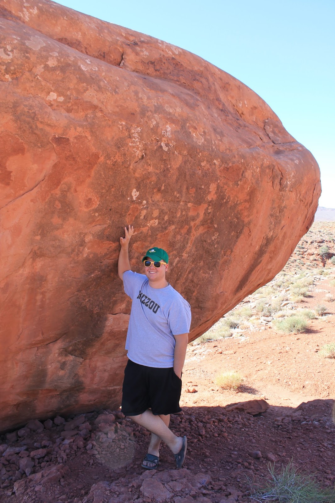

Geologist's Mecca
Grant outside the Back Door of
The North Rim Grand Canyon Lodge

Grant considers getting a better view


Grant hangs by one hand off the rim
to get a better view


Grant on the North Rim


Point Imperial


Angel's Window


Atop the Angel's Window arch


We scurried from Imperial Point to the Angel's Window and then caught the sunlight's final rays coming from behind the one of the few clouds as the day came to a close and the walls of the Canyon shown in glory at Cape Royal.  Grant thought it would be good to watch the sun set from a spot on the north rim, but I sadly had to admit that once the canyon fell into shadow, the best of the show was over and we would not regret getting back to camp and setting up the tent and start cooking dinner sooner rather than later.  As both of these activities go far better in daylight (or at least twilight) than in darkness.  He agreed.

I had carried kindling and logs supplied by the sweet gum tree I had cut down in our side yard.  The upper part of the sweet gum had died a few years back, and the dry wood quickly sprang into a welcome dinner-cooking blaze.  We  dropped a kielbasa sausage on the grill and placed peels from our tangerines on top to add a citrus savor to the meat (it did not really add any such taste).  With the moonless night beginning to chill into the 40's, we crawled into bed.

We had seen something glorious.  It was indeed a day worth living and night of sweet dreams as our fire died into ashes.

Friday, June 28, 2013

Tales of Time & Travel v2.0: Valley of the Gods

Roll up your bag.  We're burning daylight!

With eyes blinking in the piercing desert sunlight, Grant rolled out of his sleeping bag.  We shared a few granola bars, some OJ and banana bread in our camp chairs, then swept the dust and insects off the ground cloth and as we folded it to fit below the ice chest.  With everything loaded into the cargo space, it was just a few miles out of camp when we turned off the highway for a Sunday drive over 17 miles of gravel road through the Valley of the Gods.  It was to be a slow, photo-op kind of drive.  We had reservation that evening for a US Forest Service campground on the North Rim of the Grand Canyon.

Some of what we saw in the Valley of the Gods is shown below.


Peeping at the "Lady in a Bathtub"


Mark contemplates Time
In the Valley of the Gods

Behind him, the Four Prophets
Stand Shoulder-to-Shoulder
To Keep Watch in every Direction.

The Dorsal Fin of
Some Large Subterranean Creature
One Flysch, Two Flysche
Red Flysch, Blue Flysch

Guitar Pick of the Gods
Some Deity is looking for His Pick


Exit the Valley of the Gods.
Get gas at Mexican Water where the filling station store was advertising Navajo Rugs for sale inside; but someone scratched a "D" in front of the word "rugs".  HaHa :-).

We drive west on to see the Grand Canyon.

Thursday, June 27, 2013

Tales of Time & Travel v1.1: Goosenecks of the San Juan

Volume 1.1: Goosenecks of the San Juan

Last in.  Last Out.  That was the case as Grant and I were shooed out of the Four Corners Monument a few minutes after 7 in the evening.  With the gate closing behind us, we charted the last few miles of a long day of driving for a desert camp at a primitive Utah State Park, The Great Goosenecks of the San Juan.

The daylight lingered and the molten sun hung before my eyes as I drove west.  This last leg of the day's trip carried us through a remarkable land.  The abrupt cliffs of sandstone balanced upon slopes of shale, which were in turn set upon older rocks testifying to a time when this now sun-baked terrain was once covered by a clear ocean teaming with lifeforms that would appear quite alien to us today.  While some folks scurry across this landscape seeing nothing but desolation and forsaken abandonment, as a geologist, these slopes, ledges and cliffs tell me stories and speak of wonders from the past.  With such expansive vistas beyond my windshield, my eyes read the stories of extinct environments told by the rock formations.  The rocks have become my friends and it is good to see them and listen to them.

Many of the slopes are colored a hearty, thick, brick red; a result of the oxidation of the abundant element of iron contained in these sediments.  These strata were formed by rivers and streams flowing across a broad and muddy plain.  When these rocks were still mud, Earth's dominant land fauna were amphibians, giant salamanders. This was a time even before the age of dinosaurs.  The boundary between the Permian and the Jurassic is marked by a mass extinction of most of the existing species at the end of the Permian (some place the extinction around 90% of all lifeforms). Thus the ebb and (sometimes eposodic) flow of life, environments of both continents and sea, dramatically ended the earth's Paleozoic Era, "the time of Old Life".  But, since change is a constant, new time brings new life and evolution fills in the gaps.  We come up the slope onto the Triassic and Jurassic formations layered upon the Permian, with more shales holding the bones of early dinosaurs and outcrops of petrified sand dunes of almost pure quartz, displaying festooned bedding in the rock looking like woodgrain and speaking to when this land was covered by towering, drifting sand dunes whipped and driven by the wind.

Now with the sun balanced on the horizon, we two drive through our last canyon and the stone walls catch the low sunbeams and have become as embers of a dying fire, the cliff walls glow a brilliant, warm red.  The entire landscape is radiant in hues of a monochromatic red spectrum, with perhaps a tinge toward the violet within the deepening shadows.  This land of red must be nature's way of saying stop.  And so stop we did.

Grant stretches his limbs on the edge of the Canyon
after a long day's drive to the
Great Goosenecks of the San Juan

The first time I came to this place, it was late at night and as I parked my vehicle and began to set up for a night's sleep, I placed by stuff on the ground as the wind began to pick up.  It was not until first light that I noticed that I had slept quite near the edge of a large cliff and I felt relieved that neither a gust of strong wind  or a fit of sleep-walking hand moved me over the side to my demise.  This time, it was twilight when we set up our camp.  But never-the-less, lesson learned, we set our sleeping bags and air mattresses a good 50 yards back from the edge of the precipice.

We kept it all very simple that evening.  No tent, just a large canvas ground cloth, with our bags laid on top of our air mattresses.  Dinner was also very simple, it was a few small tangerines, banana nut bread (I baked the night before we left) with water and chocolate chip cookies for dessert (cookie provided by Aunt Susan while we stayed in Wichita Falls).

Side Note: We traveled long and far with that heaping bag of chocolate chip cookies, and in the jostling and shuffling and unpacking and packing, some of those cookies were broken to crumbs and dust as the trip wore on.  Do you believe in ghosts?  I swear that up to the very last day of our travels I could smell those phantom cookies at times inside the car.  I guess I like to thing of those dashed cookie crumbs not as phantoms or ghosts - but as comforting little cookie angels watching out for us on our journey.  Thank you Aunt Susan.

Once the dusk deepened into a dark and moonless night, Grant and I slipped into our bags in the still warm desert air and pointed out the Big Dipper, the Milky Way, Venus and Mars, "The Red Planet".  But as the rocks around us tell those who listen, Earth was once "The Red Planet", as climate, environments and even planets change.  We slept well.

Desert Camp at Daybreak
Mid-June days are long, and begin early.  I was up with first light, but lingered for a while within my polyester cocoon.  I knew Grant wanted to sleep longer (and was doing so).  I crawled out into the open and wandered about on the cliff's edge.  The brim of this canyon was the Honaker Trail Formation (Pennsylvanian age), a limestone and the very formation that was the subject of my Master's thesis at the University of Texas.  Though my field area was in Colorado, high up at Molas Pass between Durango and Ouray. 

The San Juan River cut these "gooseneck bends" as a classic example of an entrenched meander.  The San Juan River was originally flowing over a much different terrain, but as the Colorado Plateau began to rise beneath the river, the river kept its course and gradually cut down into the rock that was being uplifted beneath it.  The uplift of the Colorado Plateau is responsible for the Grand Canyon and many of the other spectacular geologic features and formations found in the American Southwest.  At the lip of the canyon, there is a book to register your name and home and add a comment .  It is interesting to note that most of the visitors to this far flung corner of the United States are from Europe. 

I greeted the sun and then picked up a piece of the Honaker Trail limestone and gave it a little good morning peck as well.  Hello old friend.
It is a another fine and good day for adventure!
Let rise and enjoy the journey! 
The morning light begins to seep down into
the canyon of the San Juan River
flowing 1,000 below the rim of the canyon.
Still slowly eroding as it cuts its channel
deeper into the Paleozoic sediments beneath.
  
Grant checks cell coverage for social media and sports updates in the remote American Southwest desert.


Wednesday, June 26, 2013

Tales of Time & Travel v1.0: Four Corners

Thus begins my tales of adventure, enjoying the journey to Oregon and returning home.

Volume 1.0: Long Leg and Four Corners
As was once my traveling custom, I like to get a late start.  I reverted to this fine old custom once again and arranged as it were, a pre-trip trip.  The plan for day 1 was actually a plan for day 1/3; a journey of a mere 165 miles to Wichita Falls from Garland.  A mid-afternoon departure from Garland would allow some last minute loading of supplies, battening down of computers and various issues at the office and then some yard work before I left my fields fallow for a fortnight.  Of course final preparations took a bit more time than anticipated and the lighter traffic I was expecting on a get-away mid-afternoon Friday turned into heavy get-away traffic by 4:30 when we actually backed out of the driveway for points west.  A road closure of indefinite time, only 60 miles out of Dallas, caused me to retrace my tracks and take a new route to Wichita Falls where we planned to fall in with my brother-in-law and his wife.  We got to the Cook household by 8 PM and enjoyed dinner with Bill and Susan.  Their gracious accommodations provided for a wide-open and immediate shot to head on down the highway the following morn, as it was going to be a very long drive of about 800 miles to our Utah destination the coming day.

I did have some flexibility in this our first and largest leg of our Journey; we could make the Great Goosenecks of the San Juan State Park in the SE corner of Utah, or we could cut north off of I-40 in the middle of New Mexico and make camp in southern Colorado.  The calculation being that if we stopped in Colorado, we could definitely make a stop at Four Corners (nee National Monument, and now Navajo Tribal tourist attraction).  Otherwise, if we shot for Utah, as originally planned, we may arrive at Four Corners too late to find an open gate.  We had been disappointed by a closed gate there before.

Is getting to the Four Corners site important?  In a word, Yes.  It was 3 years hence when Grant was traveling with Sue and I, and I pointed out to Grant that there was a small metal disk that had a + sign etched in it that marked the one and only place in these United States where as many a four states were contiguous.  Grant, showing a spark of adventure, said, "I think we should try and go there."  Not wanting to suppress such adventurous notions, I "stepped on it" and drove fast over the two-lane highway winding through deep arroyos and hills of desert scrub brush, only to arrive at exactly 8:00 PM, just when the BLM ranger was closing the gate as we turned into the drive.  He shrugged the universal sign of "Sorry, we're closed for the night. Nothing I can do muchacho."  Would you believe we missed it by that much?

This time, I impatiently waited my turn at the last good fueling station in Gallup, NM for the final push into vacant country.  We gained an hour as we crossed into New Mexico - that's a plus, as is the 75 MPH speed limit; so I watched the clock as we approached our northward turn to Ship Rock, NM off of I-40.  We were making good time.  Grant was feeling confident we would straddle all four states in a single stance that very evening.  Meanwhile we were fighting a blustery headwind through Navajo Nation.  As the road was at times momentarily obscured by clouds of sand and ochre dust, I asked Grant, "What do you think of this weather phenomena?"  He replied it was sort of cool, as it made it look like we were on the Star Wars planet, Tatooine.  Good thought.

With a zig onto small state highway in New Mexico and then a zag onto another small highway in Arizona, the clock on the dashboard read 6:50 (Mountain Time).  This time we were not to be denied, right?  On the verge of the Colorado state line, the clock was nearing 6:55 as we pulled up to the Four Corners erstwhile National Monument.  Cars and campers were streaming out of the gate, but yes, the gate was still open.  The BLM sign had been replaced by a somewhat crudely lettered sign indicating that the place was now run by the Navajo Tribe, and where the hours of operation once read "Open 8:00 AM to 8:00 PM", there was now a new board nailed over the closing time, indicating they close at 7.  Will they let us in with 5 minutes to go?

I rolled down my window as I approached the weather beaten toll booth just inside the gate, a tribal lady in the darkened interior turned to me and shouted, "OK. You can go in and take ONE PICTURE.  Then we are CLOSED."  We'll take it - and she did not even collect money from us. There were about 3 cars of stragglers still in the parking lot when we screeched to a halt.  The young kids that had bounded out of those cars were hamming it up on the cross-hatched plate the designated the intersection of Colorado, Utah, Arizona and New Mexico. 

Four Corners.  Only place in the Us where four states
are contiguously joined
It would be rude and unseemly to knock those kids off the marker, but I could hear the hobnailed boots of the Navajo lady as each step she took crunched along the gravel walk.  We were running out of time and after driving for 700-plus miles, I was not going to be denied.  As the kiddos, unaware of time and protocol sashayed on and off the marker, I handed Grant my camera and said, "Quick, shoot me!" as I cut quickly onto the momentarily vacated marker.

In the fashion of the old Twister game, it was Left Hand: Arizona, Right Foot: Utah.  Grant them moved toward the + spot as the lady announced, "We're closed!".  But we made it,  We hit our first mark, and perhaps the most difficult of this trip. 

I find it an interesting twist (ironic?) that the Navajo construct their dwellings, hogans, always as a circular structure with the door on the east.  I have heard that some Navajo find it discomforting to live and sleep in a structure with corners - yet here they have been given dominion over a place named "Four Corners".  The epitome of a culture clash, the western foundation built upon cartesian coordinates and boundaries and demarkations, while the Navajo see the world as circular and moving and without lines.


Left Hand - Arizona
Right Foot - Utah
A New Spin on the game of Twister

Grant hip-checks small kids to get his turn at the
Four Corners + Spot as time expires
Families hamming and reclining in multiple states
 On this journey, we would traversed 8 states.  But on this, our first day of travels, we covered four states at once -- how is that for efficiency? 
Boo-yah!

With the sun low in the west, we hopped back into "The Q" (nickname for the Toyota 4Runner) and put on a few additional miles driving into the sunset for a night of camping in the Desert at The Great Goosenecks of the San Juan, Utah State Park.

Tuesday, June 25, 2013

Tales of Time & Travel v.0.0: Epilogue

These are the tales of a summer of far-flung, free-wheeling, fanciful and sometimes fast, travel and adventure:

On the penultimate day of our two weeks on the road, I lightly gripped the wheel of the 2006 Toyota 4Runner as we cruised Interstate 70, transecting the rust and golden hued warmth of the surrounding mesozoic sandstone cliffs.  Grant, my son, looked up from his iPhone and with a moment of insight and suggested to me that the theme of this trip seems to be time.  I accept his insight and believe it is truly a fitting theme. 
     Time to seize the Future: As the family all gathered in Eugene, Oregon to celebrated his older sister's commencement from the University of Oregon - a full fledged Duck.  With pomp and circumstance, Inga graduated with honors and now charts her future into the real world.  Witnessing the transition to the future was the prime impetus for the journey.
     Time to seize the Present:  This was a father-son trip.  One I am sure I valued more than Grant, this kind of appreciation only comes with time and perspective of a parent. This is likely a once-in-a-lifetime journey for the two of us.  Grant knows well my philosophy, "enjoy the journey".
     Time to embrace the past:  A somewhat unexpected facet of the journey developed as I reconnected with old friends from Madera High after wandering away from the San Joaquin Valley some 33 years ago.  My spirit was warmed beyond my expectation as I rekindled those connections that I thought lost, only to discover the bonds were not as tenuous as I had always believed. Also embraced was a wonderful, albeit short, reconnection with kin; two of the Maher cousins in Portland and almost a third in Tahoe as well as Nephew Scott who joined in Inga's graduation celebration from Portland by way of Bosie, Idaho.  I would hope to continue these reconnections from the past into a "future time".
     Time of eons and epochs of the incomprehensible past:  As a geologist, this journey brought us intentionally through some of the most fanciful and an strangely inspiring landscapes on the planet.  We allowed some time to poke about on the Colorado Plateau, driving on dust-drenched roads beneath towering stone exquisitely carved by the humble elements of wind and water in the Valley of the Gods, Utah.  We journeyed through the Navajo Nation through billowing clouds of ochre dust as we pasted Ship Rock a volcanic plug punching the bald desert sky; a rock formed by once violent and belching fire and now silent, overlooking the surrounding hogans and the occasional goat herd.  We peered over the Grand Canyon and marveled and then made camp near the rim that night. 

We saw and did much in our time of travel. 
The numbers that sum up our travels would read that we drove 5,871 miles, we used 281.5 gallons of gasoline, we averaged 20.8 MPG and paid from a low of $3.319 (Garland, TX) to $4.099 (Madera, CA) per gallon.

We made 26 stops for fuel, and I find these random names at our refueling locations an interesting study in the American lexicon of geography.  To wit:

We stopped in Las Vegas, NV (Spanish. the meadows) and Vega, TX (Spanish. meadow).  I found the plural location, Las Vegas, resembled nothing like a meadow, while the singular Vega location was on the windswept high plains and appeared to be as much wishful thinking and hopeful naming as was Las Vegas.

We bought gas in Glenwood Springs, Colorado Springs and Springfield.
We bought gas in Wichita Falls and Klamath Falls, neither of which readily have falls apparent.
We bought gas in Amarillo, TX (Spanish. yellow) and Redding, CA; while Utah was far more vibrant in both yellow and red landscapes.
We refueled in Gallup and Mexican Water (I have always heard that if you drink Mexican Water, you will get the trots - which may turn into a Gallup).
Our gas stop with the most interesting name?  A) Mexican Water, or B) Rancho Cucamonga?  My vote goes to Mexican Water, by vitue of a sign on the gas station advertising "Navajo Rugs Inside", but some joker added a "D" in front of the word "rugs".

But the coming words and the photos I hope will give a better sense of what we experienced, and in some small part I hope you, the reader, will find a way to enjoy the journey along with us in the following posts [as I find time to record and publish them in the coming days].
        

Sunday, June 2, 2013

Remembering the Fallen

Memorial Day.

The first thing I did after stepping from my bedroom was to unfurl my American flag and proudly place the Star and Stripes in the mounting bracket on my front porch brick column.  There it waved in the muggy breeze as a sign of my respect for those who have served.

The Memorial tribute being now set, it was time to turn to the next item on my to-do list.  The old Liquid Amber tree, known in these parts as a Sweet Gum, had displayed wondrous shades of reds and purples over the past handful of Autumns, throwing splendid colors upon our side yard.  But, it's service had run its course and after several years of drought and nature's own morbidity, the Sweet Gum tree became mostly a snag of dead and dried wood.  It was (or has been) time to bring colorful sentinel down to be laid up for next Autumn's firewood.

With a rip and roar of my chainsaw, I lopped of some of the branched that weighted the trunk toward my neighbor's roof, giving the remaining branched weight and impetus for a fall-line between our two houses and onto my half of the lawn.  I made the notch at a comfortable working height, and angled it at what looked like a safe direction - away from the eves and expecting it to fall toward the street and land upon the grass.  With my notch cut out of about 1/3 of the diameter; I then made my back cut.  With a creak, a few hushed splintering sounds and a whoomp.  It was down, and it landed right where I had planned it.

It was a day to remember the fallen.


I pause to remember the fallen