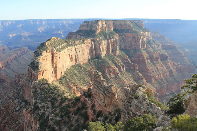
When it comes to the Grand Canyon, it is best to not start with words, but rather a picture.
Of course, when one comes to the Grand Canyon - one actually has to get there.
Grant had expressed an interest in seeing the Grand Canyon during the planning stages of this epic journey; and such a request, even if not voiced in full throat with accompanying vim and vigor, should by all means be granted. Our journey to the Grand Canyon was expected to be a day of relatively few hours and few miles as we planned only to drive from Utah's SE corner over to Arizona's NW corner. A route that would bob-and-weave, dip-and-dive south and then north of the common state line in sine wave fashion. But in the canyon lands of the Southwest, short routes as the crow flies are often more circuitous as the crow drives overland.
We were headed for the North Rim of the Grand Canyon; one, it is less crowded (more pleasant) than the South Rim and we would again be camping at a reserved US Forest Service campsite and I wished to avoid crowds; second, this location is at an elevation of 8,800' and expected to be a cool night high above the desert, great for a sound sleep; and thirdly, a more direct - and better yet, a more adventuresome route off the Interstate highway (at least until we were ready to make quick time from St. George, UT into the Los Angeles Basin the following day). My "Plan A" was to drop south into Arizona, then turn north up to Page, AZ, then go south again and then turn north to cross the Colorado River at the east end of the Grand Canyon on US 89. After recharging Grant's iPhone at a Jack-n-the-Box in Page, we left town only to find Highway 89 had a sign saying, "Closed Ahead". The question in my mind was "OK, yeah, but how far ahead?" We need to go only 25 miles before we turned north again, could we make the 25 miles? Grant suggested we try. We tried. We failed. We drove 18 miles before the road was closed - but now I had an answer to my question. We back-tracked north to Page and took the northern circuit up through Utah and then back south from Kanab to the North Rim.
Once in the Park, we inquired about the closed US 89, and were told that the road is still there, only now it is located at the bottom of the cliff. A caution to the driving public, you will find a 1,000' drop, a resulting little jolt, and then Highway 89 continues.
Enough words. A few selected photos.
 |
| Geologist's Mecca |
 |
Grant outside the Back Door of
The North Rim Grand Canyon Lodge |
 |
| Grant considers getting a better view |
 |
Grant hangs by one hand off the rim
to get a better view |
 |
| Grant on the North Rim |
 |
| Point Imperial |
 |
| Angel's Window |
 |
Atop the Angel's Window arch
|
We scurried from Imperial Point to the Angel's Window and then caught the sunlight's final rays coming from behind the one of the few clouds as the day came to a close and the walls of the Canyon shown in glory at Cape Royal. Grant thought it would be good to watch the sun set from a spot on the north rim, but I sadly had to admit that once the canyon fell into shadow, the best of the show was over and we would not regret getting back to camp and setting up the tent and start cooking dinner sooner rather than later. As both of these activities go far better in daylight (or at least twilight) than in darkness. He agreed.
I had carried kindling and logs supplied by the sweet gum tree I had cut down in our side yard. The upper part of the sweet gum had died a few years back, and the dry wood quickly sprang into a welcome dinner-cooking blaze. We dropped a kielbasa sausage on the grill and placed peels from our tangerines on top to add a citrus savor to the meat (it did not really add any such taste). With the moonless night beginning to chill into the 40's, we crawled into bed.
We had seen something glorious. It was indeed a day worth living and night of sweet dreams as our fire died into ashes.


No comments:
Post a Comment