Sunday, July 13, 2025

Lions and Tigers and Bears! Oh, My!


As Dorothy and I well know, when you are this close to Emerald City, you could encounter lions, and tigers and bears. Oh, my!

Maurice returns to my (or is it his?) apple orchard to check on this year's apple crop

I'll be back - Maurice (July 8, 2025)

Well, so far, it is 2 out of 3 for lurking dangers on The Pilchuck.

Maurice, the black bear, has been seem three times in the first half of 2025 [as far as I know, maybe more]. He first stopped by the place on April 30th. He and I exchanged surprised looks a few weeks later as I was heading down the driveway to throw away a spoiled piece of ham into the trash can before the trash was to be picked up later that Wednesday afternoon. Maurice was coming down the road that joins the driveway at the 'Y'. Maurice's chosen path that morning splits off the driveway and leads into the back 40. 

I saw him and I stopped in my tracks. 

He saw me and he stopped in his tracks.

Maurice beat it into the forest brush and I tossed the piece of meat in his direction and returned to the house. Win - win.

Maurice was back on July 8th to shake my tree. The apples are not yet ripe, so I expect him to be back later in the month. He really loves my apples and wants to shake my tree. [Ref. The Joker, Steve Miller Band

***

What I did not expect was to meet a lion on The Pilchuck. I'm not making this up - yes! A lion.

I was looking out my dining room window in the late dusk July 11th and noticed two does back grazing in my field, as they often do in the evening. I was on the phone with Sue and made mention that my deer friends were back this evening. I pointed the phone out the window at her request in hopes she could also see the does. They were about 300' away and not easily seen on the phone's screen.

The two does were walking in the knee-high green grass and yellow flowers with stiff-legged, dainty and cautious steps. Unusual gait, I thought to myself.

I returned to my chair and turned to watch the deer, but they were suddenly gone. Often they will slowly graze and move across the field in a casual nonchalance. I looked harder to see where or why they had disappeared from my view so abruptly.

I saw my answer prowling up the edge of that field along my driveway. I saw a large mountain lion coming toward my house. I stayed on the phone with Sue describing the incredible sight of seeing a cougar hunting out in the open just outside my dining room window. I flipped my cell phone into camera mode while still doing play-by-play on the lion hunt happening before my eyes.

The deer must have sensed the predator in their midst and bounded for safety somewhere out of sight. I tracked the mountain lion moving closer to the house, holding my camera on this amazing animal. I moved from the dining room to the living room window to get a better angle on the stalking wildcat. I watched as it came up to my SUV and slipped behind the far side. Anticipating that the lion would pass along the north side of the house, I walked briskly to the window in the door for my back porch. Still calling the play-by-play, I said to my wife; "He's heading for my back porch, I'm going to make sure that door is locked." I don't have door knobs, I have lever handles on my doors, the kind of shiny silver things that just might attract the attention of any kitty cat to swipe at - and then find that in swiping at it, it opens into my mudroom. 

Expecting the cougar to walk past my house, I was surprised to look out my porch door window to see that it had silently climbed the steps and was standing two feet on the other side of my door. I pointed my video camera, the wildcat unaware of my nearby presence as I was recording it at a little more than whisker-length away from its fangs. I threw the bolt on my door lock as the cat paused, looked into the woods, its whole, long, sleek, golden body taking up the length of my porch before it make a quick move, turned around and walked into my backyard and disappeared into the thimble berry thicket.

Sue was begging for me to send her my pictures of the mountain lion. I checked my photo gallery only to face great and sincere heartbreak. I had not realized that I had not activated my video on my phone. Such a once-in-a-lifetime opportunity to record a lion on my back porch from two feet away was gone. Dreadful sorry to have messed up this amazing opportunity. I try to live a life of few regrets, but this failure has to count for a huge regret in my life.

Who knows? I may get to see this mountain lion again - but I am not so sure that I want to encounter a prowling lion in the forest on my 50 acres. It was exciting to see it come up to my porch while I was safe inside. Not as eager to meet him on his turf, even if I technically have title to this plot of land.

I googled 'Mountain Lion deaths in US', finding the AI answer that mountain lions attacks and deaths in the US are rare, [about 32 human deaths in the last century] but do happen. 

***

I've enjoyed having numerous guests come to The Pilchuck this summer. Sue flew up to Seattle in mid-June. A few days later we two were joined by our son Grant, his wife Kaileen from New York City and her parents from the Houston area for several days. Later, Inga and Sean came up from Portland for a visit. While the family was here, the major wildlife sightings were absent.

Once all of my guests left, I have seen deer, bear and a mountain lion. The apex predators have come to pay me a visit. Lions and tigers and bears! Oh, my!

Well - two out of three.

I let you know if I catch a tiger by the tail. But right now I've got a mountain lion by the 'tale'.


Friday, June 27, 2025

The Tide is High

It seemed like a good idea at the time.

One of my favorite, little know spots of tranquility and beauty is towering conglomeratic outcrop charted as Delta Rock, jutting above an undiscovered beach and accessed through a marshy, at times muddy, tideland. As tour guide for my summer visitors I had a couple of ideas - good ones, or so I thought.

Idea 1: We will  drive across the Rainbow Bridge (yes, this is the real name of the bridge leading from Fidalgo Island to La Connor. One is to remember your dead pets on your way into down over the Rainbow Bridge) where we will enjoy a late lunch. For dessert, we will cross the Skagit River to Fir Island and fill ourselves with what are billed as 'immodest ice cream cones' at the famous Snow Goose Produce Stand. Idea 1 turned out to be a good idea.

Idea 2: After stuffing ourselves with an immodest amount of fruit flavored creamy cold goodness, I will lead our party on a hike across the tidal flat to Delta Rock for a serene view at the edge of the sound and the idyllic sandy beach at the mouth of the Skagit River.

Sue lead the way through cattails and reeds
on the tidelands trail to Delta Rock


The tideland trail began relatively dryish as it threaded the way through tall cattails, reads and over rivulets of tidal channels incised into the mudflats.

There were soggy parts. there was maybe some hesitation, but I led onward in the name of enjoying the journey and for the view awaiting us bold travelers.

Then, there were wetter parts. Socks and shoes got soaked. We pushed onward toward Delta Rock rising in the middle distance but half a league onward.


Picking our way through a muddy tidal flat

  We waded, we wallowed, we was wet. 

I had not expected our path to be so sodden. The tide must have come in. 

The mouth of the Skagit inundated by high tide 

Where I expected beach was covered in salt water,
prime conditions for shrimp boats just beyond Delta Rock

We clambered up the side of Delta Rock. There was no beach. The tide was high and had covered the lonely stretch of sand I was expecting on this late fine, summer afternoon. Instead, there were several boats fishing with nets during this opportune high tide at the mouth of the Skagit.

I apologized to my party. It was beautiful scene all the same, but missing elements of sand bars and a long, lonely stretch of fine beach sand. Timing is everything.

Sunesons and Gauls take in the westward view from the brim of our solid  high ground

Muddier on the way out 
than on the way in. Yuck!


We scrambled off our perch above the rising tide, a tide higher than average. We discovered that our path out was now wetter, soggier and mud muddier than when we came in.

There was just no way to avoid wading through knee-deep tidal channels to get back to the cars. It was not a disaster, but it was not all that pleasant of a way to end the day.

I had hoped for better for my guest whom I had led astray through marsh, matted marine grass and mud.


It's a good thing that I designed my house with a mud room. Upon return to The Pilchuck, we bowed and muddied six, all scraped off our soaked shoes, wrung out our sodden socks and peeled out of our soiled pants. Thus began a long evening of laundry.

Lesson learned: check your tide tables.

Like Blondie and I were saying, it seemed like a good idea at the time. But I'm not the kinda guy that gives up just like that...


The tide is high, but I'm movin' on.

From Toes in the Breakers to Heads in the Clouds

While on Fidalgo Island, it was a short drive from the gravel shores of Rosario Beach to the rocky heights of Mount Erie. Hoping for a break in the clouds and the inspiring view from the crest of Mt. Erie, we left our sea level adventure for a mountain top experience - if not view.

The view from the top of Mount Erie was not extensive,
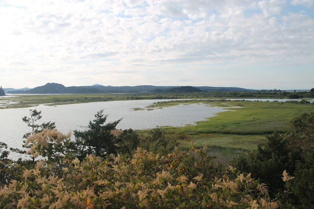
but we could see an island in a lake on an island.


Sunesons and Gauls gather in the amongst the clouds 
Mount Erie overlook.


We had gone from an elevation of 0 feet at sea level to a height of 1,273 feet.

We got a sense of the islands and channels beyond Fidalgo and Whidbey Islands. Then we got hungry and thought a return to La Connor for lunch would be a good idea. And it was.


Rosario Beach, Tidepools and Headlands

 The sun rose on another day in the pacific Northwest.

Or, as is often the case the darkness became a lighter gray signaling it was daytime.

Either way, our guests, the Gauls, described their approach to vacations as a "time to assault the location." The assault was scheduled after we had a leisurely breakfast, the target was Rosario Beach.

Grant explores Rosario Tidepools
Rosario Beach is a State Park with rocky headlands and of interest to us and most everyone that visits, are the tidepools and the chance to see some amazing marine creatures.

We walked down to the shoreline and crept over the barnacle-covered rocks at low tide. Peering into the tidepools, watching several species of crabs, identifying some mollusk denizens of the pools and getting a chance to see seastars and sea anemones tucked in the crooks and crannies of this storm-worn piece of shore rock. So cool.


Glenda and Grant searching for sea creatures


A heron looks for lunch at low tide


Leaving the tidepool area, we strolled up the path to the headlands atop the sea cliffs bordering Deception Pass, separating us from Whidbey Island.

The sky was gray, the water pewter, the air was cool. No matter the weather, I always find the Rosario Headlands to be scenic.

Kaileen and Grant on the edge of the cliff

Mark and Sue overlooking Deception Island

Greg does some checking on our geographic location

Silhouette of the Gaul Family 

Sue and Goats Beard shrub


A Journey to 'The Islands' in Washington's Banana Belt

 For a change of pace. For a chance to give our tender feet a rest after hiking in the Cascades, we opted for a relaxed day of sightseeing. We opted to book walk-on foot passage on the Washington State Ferry System and catch a ride from Fidalgo Island (which in my mind counts as 'mainland') Anacortes to Friday Harbor on San Juan Island.

Glenda, Kaileen, Grant and Sue waiting for our ship to come in at Anacortes Ferry Dock

The Yakima has docked and will ferry us to Friday harbor for a leisurely day on San Juan Island

Getting there is half the fun when you ride the ferries that sail Puget Sound. We had sunny weather, fair winds and a rising tide and then we cast off for a day of adventure.

The locals know that the San Juan Islands fall in the rain shadow of the Olympic Mountain Range, the height of the Olympics blocks some of the rain and gray weather typical of Western Washington, allowing the archipelago of the San Juans to trend warmer and sunnier that other coastal stretches of the state. Hence, the humorous phrase, 'Banana Belt' for these charming islands. 

Greg was kind enough to buy us all a waterfront lunch in Friday Harbor

Lavender crops are grown on San Juan Island  


Mark swimming with the Friday Harbor Seal


Grant and his mother at Friday Harbor Marina

Mark Posing with Petunias & Poesies
Shop along the street of Friday Harbor

We moseyed along the flowered streets of tourist-oriented Friday Harbor for the afternoon. Mostly window shopping before we caught our return ferry to Anacortes, arriving around 6 PM. I think there is so much more to do on San Juan Island than the tourist town of Friday Harbor, that I'm keen to return some day with more mobility and go sea some of the beaches, historical sites and less-visited towns on the island. I'm thinking in the future, maybe this would be a good 2-day adventure to scout San Juan Island with my wife. No regrets. We will continue to enjoy the journey and plan accordingly.

We were off the water with most of the day already gone. We detoured through the picturesque town of La Conner. We walked along Main Street, peeking into gallery windows, shops and dinning locations that were closed, or about to be. 

Those in our party from New York City marveled at the small town sense of time, where retail establishments closed 'so early' at 5 or 6, the shopkeepers then returning home. "Isn't anybody willing to work and stay open anymore?" was the lament as we passed darkened shops. 

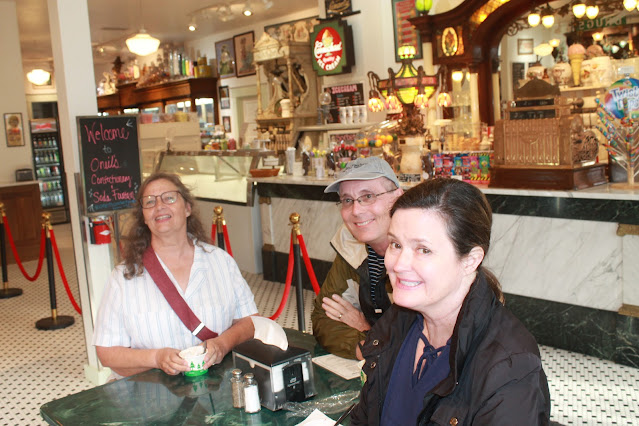
We found a well decorated shop serving ice cream and open until 7. We dashed in to enjoy a creamy confection - just ahead of closing time.

The summer days in Washington are long on daylight, but short on business hours in La Conner.
We find an ice cream parlor still open and decide to have dessert before dinner - we are on vacation!


Of course, no trip to La Connor would be complete without a photo with the statue of Dirty Biter. Dirty Biter was a beloved, if not cantankerous canine who owned the town for awhile. We have many photos of Sunesons over the years posing with the bronze likeness of La Connor's famous Dirty Biter. 

This day is no exception... 


Kaileen joins Grant in the latest edition of a photo with the Dirty Biter Statue

Then it was back to the Pilchuck for leftover pizza and pot roast now that we had started the meal with ice cream in La Conner.


Thursday, June 26, 2025

Waterfall Wonders

Sue and I had a couple of days together to get the house set up for the excitement of our arriving visitors; our son Grant and his wife Kaileen flew to Seattle on Sunday, June 21, where they were greeted by Kaileen's parents, Greg and Glenda, who had arrived as tourists a day earlier.

Greg had rented a car and met Grant and Kaileen at the airport in the morning, they toured Seattle's Pike Street Market, the Chihuly Glass Art Museum and did some wine tasting before driving the 50 miles north where we had a pot roast supper waiting for them.

I had laid out some options for places of interest in the Pacific Northwest; they had prioritized nature and pleasant hikes with an emphasis on scenic waterfalls and woods. I looked them in the eye and told them, "I will make that happen. Follow me!"

In the morning I took them up the road about 25 miles to the Boulder River Wilderness Trailhead. Plenty of woods to begin with and a promised beauty of a waterfall after an easy 1.2 mile trail.

Boulder River Wilderness Trailhead
Greg, Glenda, Sue, Kaileen & Grant


We examined the geology of the bedrock, the plants and gnarly tree roots and exchanged convivial chatter and before we knew it, standing before us was the unnamed forked waterfall was rushing over the precipice on the other side of Boulder River.

Embraced within the folds of a massive cedar tree on the Boulder River Trail

Sue and Mark share roots


Rounding the trail that followed the contour of the steep slope, the waterfall (which I feel should be named 'Dragon Tongue Falls') came into view. We all scrambled off the trail and down the rough slope to walk and hop among the boulders of Boulder Creek at the base of the falls.

Kaileen & Grant at trail's end for Dragon Tongue Falls


***

We hiked back to our cars at the trailhead where we discuss our plans. It was decided to grab some lunch at the Burger Barn in the small town of Darrington a few miles further up the road.


After lunch, "Anyone interested in another waterfall?" 

I explained it was a rather short hike to see North Fork Sauk River Waterfall, a full-blast, roaring waterfall, in contrast to the flittering, tranquil essence of our morning's first waterfall experience. In answer to my question, it was a resounding, "Yes!"

We traveled in tandem over about 16 miles of unpaved seasonal road know as The Mountain Loop Highway. 

The springtide flood and volume made for a spectacular sight.


The roaring North Fork Sauk River Falls

Sue silhouetted against the backdrop of an impressive waterfall 

Grant and Greg managed to scramble over the rocky, semi-blazed trail to stand on the bedrock at the base of the falls. Kaileen, being the social media poster extraordinaire, got some great shots of the place to post to her friends and adventure followers.

***

It was mid-afternoon, and I had a suggestion. Since we've come this far, how about we finish this Mountain Loop of a so-called highway, and go see a series of waterfalls cascading into an avalanche shoot piled high with the winter's snow where the water carves out an ice cave at the base of Big 4 Mountain?

Wheeling over the pothole pocked dirt road that is the Mountain Loop Highway, we crossed over Barlow Pass, leaving the Sauk River watershed and descended into the Stillaguamish River watershed and some spectacular views of some of the peaks of the Cascade Range. We parked at the Big 4 Mountain lot where once stood a grand hotel, until it burned to the ground in 1938.

Walking along the path to the trailhead, a busy beaver was spotted hauling a 3-inch diameter piece of wood and paddling through the one of its beaver mash waterways.

Beaver viewing from a boardwalk above the marsh at Big 4 Mountain


It was enjoyable hike through marsh, across an aluminum bridge and into the woods where several redheaded woodpeckers were spotted. We were warned by signs not to enter the ice caves as there were at least four different ways in which one could die; killed by falling rocks, killed by collapsing ice, killed by falling through an ice crevasse, or killed by an avalanche.


At the end of the trail, we viewed the ice caves beginning to form at this early stage of the seasonal melt, from a safe distance. I was tempted to challenge fate and get closer, as I think was Grant, but in deference to our wives, we held back our adventurous exploration.

A stern warning from the US Forest Service

Sue with avalanche chute and waterfall at Big 4 Mtn


With a good day's worth of waterfalls collected in our minds, we passed through Granite Falls and headed back home. We called in an order for some Greek-style pizza for pickup on our way home. 

We estimated (using their cell phone tracking) that we hiked between 7 and 8.5* miles in our treks to see Pacific Northwest waterfalls.

*Different devices had different estimates.

We kicked off our boots, devoured our pizza dinosaur-time style and opened a few brews in the long-lasting evening light of this latitude.

"What do ya got for us tomorrow, Mark?" Someone asked.

"We've done mountains today, let's do sea and saltwater and The Islands tomorrow. We'll take it easy, relax on a ferry boat ride to San Juan Island and Friday Harbor."

Sounds good. See ya in the morning. Goodnight.

Friday, June 20, 2025

Like Spawning Salmon, We return


Like spawning salmon, we return...


At the entrance to Ivar's Salmon House, Seattle
March 28, 1986 - June 18, 2025

Ah, I remember it well...

Well... maybe I sorta remember some things from 39 years ago. 

I definitely remember feeling rather giddy and comfortably wonderful about my wedding scheduled for tomorrow. The rehearsal had gone well, my best men, Paul Gold and Chalmer McClure had goofed around, we posed for a few eccentric photos wedged into the formal rehearsal space at University Presbyterian Church in The U-District in Seattle.

With places, timing and roles all discussed, practiced and memorized, it was time for everyone in the wedding party to join us at Ivar's Salmon House for the pre-nuptial dinner on the shores of Lake Union, under the shadow of the towering I-5 Ship Channel Bridge. The food was good, the company was great, as I remember it.

It is an interesting exercise to skip through all the twists and turns that our life has shared in the years since we first dined at Ivar's; I find myself having built a new, whimsical house on the 50 acres on which my bride was raised. As fate would have it, I am mostly living in our Washington house, while my bride is living at our house in Texas where we raised our kids and spend the majority of our lives the past 35 years.

It is exciting that for a few weeks this summer of 2025, we will be reunited under the roof of our House on the Pilchuck. And in a few days, we will begin to welcome family to our house as well. Just as it had always been planned and as it should be.

Susan, my bride flew into Seattle from Dallas on June 18, landing early evening. She lands, but her cell phone (these miraculous thing had not been invented when we arrange to get married back in 1986) was not responding or dialing out. Something to do with the settings or maybe battery life. Oh, the frustrations of relying on miraculous devices.

I parked at the airport, studied the digital board of flight arrivals and noted that her flight had landed. Hoping she made her flight, I had to assume she would be somewhere inside the Seattle airport. I hung out at the baggage claim carousel paired with her flight - no bride in sight. I wandered among the madding crowds for about a half hour and found my lost (or runaway) bride shuffling through the deplaned passengers outside the TSA perimeter.

I hugged her from behind. She tried to offer an explanation as to her mysterious silence, but my lips were on hers, and so she could not really talk like a girl would want to.

We sorted things out. She had checked her carry-on bag, so we waited for it to be offloaded at Baggage Claim 14. We started to catch up with each other in person as I directed her into the cavernous parking structure to search for my vehicle.

It was around 7 PM Pacific Time, translating to 9 PM her stomach time. The eventual question came up, "Do you have an idea or plan for dinner?", she asked.

"How long have you known me? And yet you ask if I have a plan for dinner? My, we've been apart for far too long."

I exited north bound I-5 at the end of the Ship Channel Bridge and made a few extra byzantine turns through the confusing, non-orthogonal streets of this waterside Seattle neighborhood, looking for Ivar's Salmon House.

I had to ask, "Do you think Ivar's is back behind us - or should I go further down this road?"

"I think we passed it. I seem to remember it being closer to the bridge." My wife was right, of course. A reconnection with my working phone-based GPS confirmed her instincts. 

I spun the wheel around and Viola! We we right back where we both started on that glorious pre-nuptial night of March 28, 1986. We had returned. It was so fun and fitting to take my bride back to Ivar's Salmon House now that we were together in Seattle. It was just like I remembered it...

Like salmon, we return to the waters from which our journey had begun so long ago. It was good.  

About to be married - Fun in Seattle

After a night at Ivar's Salmon House
We get the married the next day.


Saturday, June 14, 2025

Barlow Point

 The paved portion of the Mountain Loop Highway runs east out of Granite Falls, following the course of the South Fork of the Stillaguamish River until it reaches Barlow Pass. There, at the summit of Barlow Pass, the pavement ends and the road descends to the drain of the Sauk River flowing north.

Peak rising east as seen from the top of Barlow Point

At the summit there is a trail to Barlow Point that advertised great panoramic views of both the Stillaguamish and Sauk watersheds far below. I thought I'd give it whirl since it was only 1.2 miles and the map showed a straight dotted line from trailhead to the vista point.

This trail was not flat, but it was climb over rocks and tree roots from the get go and it seemed much further than the 1.2 mile one way trip; I had to wonder if the distance was measures as the crow flies and did not account for the numerous switchbacks needed to gain the elevation to the top of the ridge. It was all uphill, one foot in front of the other. It took this old man 1 1/4 hours to climb the 1 1/4 miles. It was kind of beating, but once I started, I wanted to finish and not be defeated by the mountain's contours rising above me. It was 4 PM when I started, I knew I had about 5 hours of daylight left, but...  This climb was tougher than I expected.


The trail was heavily forested all the way.

Hike up, my heavy legs estimated 118 switchback traversed before I got to the top, and I though maybe I'd gained 1200 feet in elevation. I counted the switchbacks on the way down - there are only 39. And checking the map at the trailhead, the elevation gain was 800 feet.

Made it to the top of Barlow Point.
Stillaguamish River watershed behind me to the west.

Shadowed peaks to the west at 5:30 PM

Cheery colors await me on the rocky top of Barlow Point.


My ascent was hard on the lungs. My descent was hard on the knees. Happy to have made it to the top of Barlow Point and happy to have made the solo trek back down the side of the mountain.

I pointed my 4Runner downhill toward Granite Falls and pulled into the Thai House Restaurant, ordered Kee Mao, a chicken dish with pad Thai noodles, basil, ginger and peppers plus a pot of hot jasmine tea. A good day.