 |
| Forked waterfall plunges into Boulder River |
The weather forecast claimed that the rain would hold off until mid-afternoon on Thursday, May 15th. Time enough, I figured to do a little exploration in my own back yard.
I swung the gate closed and rolled up the road toward the mountain town of Darrington. I covered the 24.5 miles that brought me to the turn off to the Boulder River Trailhead in 30 minutes, arriving at 10 AM. I had high expectations that I could visit a mesmerizing, unnamed forked waterfall rushing over the rockface rising for a hundred feet or more above the Boulder River.
 |
| Boulder River Trailhead. I was the first one on the trail this morning. |
After a 3.6 mile drive up a decent (at least the first two-thirds of the way) dirt road, I parked as the only vehicle at the trailhead this morning. I tossed my rucksack on my back, stuffed with a camera, raingear and several bottles of water and was off for a scenic mountain adventure. I could hear the roar of Boulder River in the distance and far down the mountain as I closed the SUV door. The trail peters out in about 8 miles, but the point of interest, a majestic, split waterfall was only a 30-40 minute hike with moderate elevation gain.
The beginning of the trail is a wide and level grade, having once been a narrow gauge railroad built to extract timber in the early 20th Century.


 |
| Large fir trees cling to boulders on the steep slope above the river |

I was expecting my boots to be kicking across a terrain of dark andesite or dacite igneous intrusives, but I puzzled that underneath all of this moss and tenacious tree roots were slopes not of igneous rocks, but of metasedimentary rocks in hues of grays, greens and blacks and a few dun patches to boot.
A boulder-strewn channel carves the narrow river ravine at the base of the northwest face of 125 foot cliff with a gorgeous double waterfall in view between the tall timber. A fast-flowing stream rushes over the precipice, cascading through two vertical channels lined with vibrant green moss.


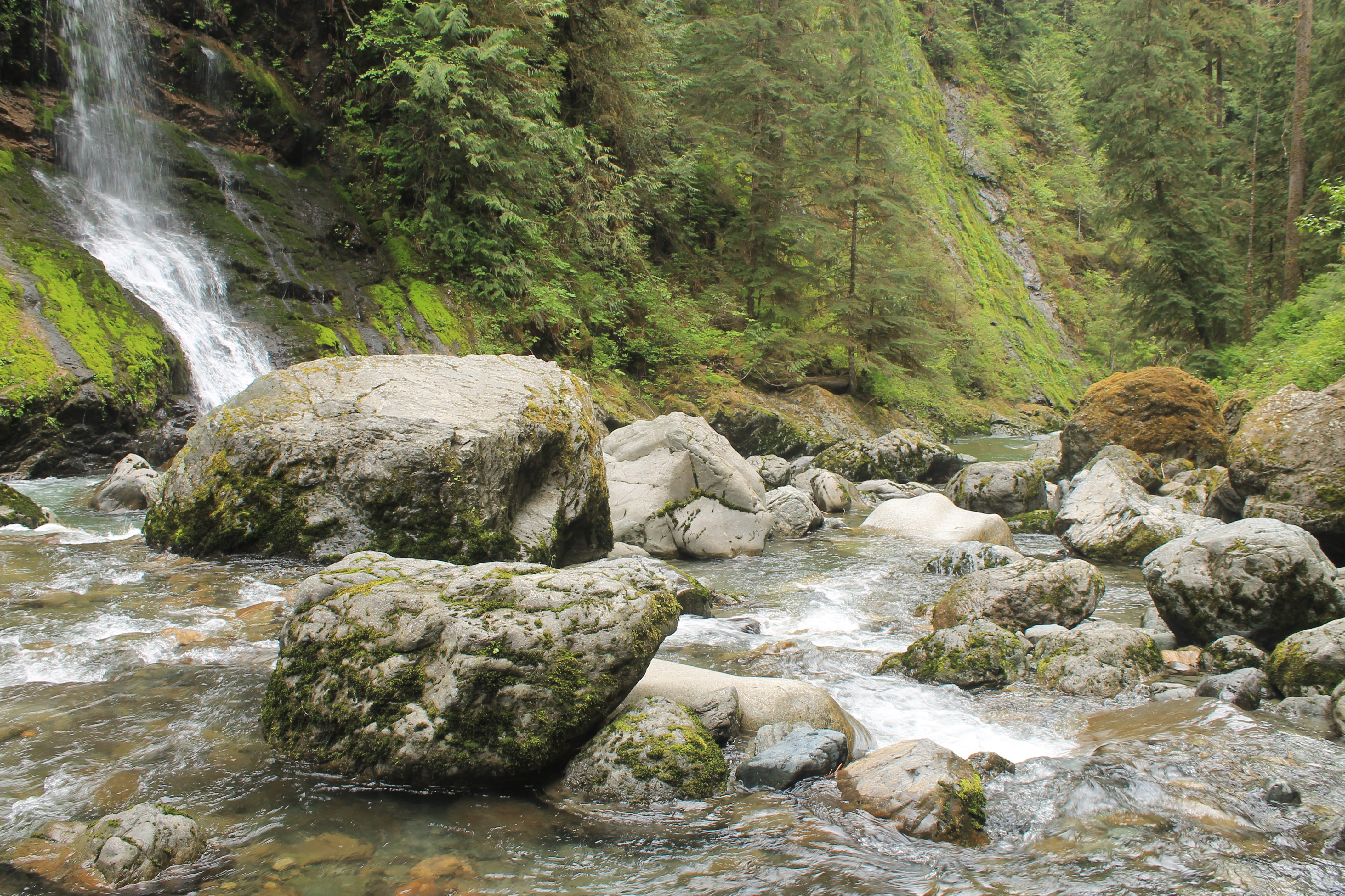 |
| Boulder River fed by an unnamed forked waterfall |

 | ||
| Forked falls framed by a moss covered forked tree. There was about a 40 - 50 foot scramble off the trail to clamber down to the river's gravel bank. The descent was steep, utilizing strategic jutting stone steps and a few horizontal logs as footholds.
It was worth it. I could have lingered and enjoyed the cacophonous serenade of kinetic waters colliding as I sat alone in the cool, misty mountain air for much longer. I climbed back up to the main trail for a peek at what might be ahead on this trail. I ventured further up the trail beyond the waterfall to see if another spectacular sight might behind around the bend and in view between the trees. Trapsing across a fallen log fitted with handrails spanning a deep ravine, I covered perhaps another mile, took a few photos of some of the wildflowers growing the the mountainside.      But I had a few other hikes and sights planned up the road. So, I turned around on the Boulder River Trail and set the toes of my boots pointing toward the Mountain Loop Highway, a mostly unpaved car path through some deep woods and mountain passes the connects the Cascade Mountain towns of Darrington with Granite Falls. |

1 comment:
Looks like Sasquatch country....
Post a Comment