Sue and I had a couple of days together to get the house set up for the excitement of our arriving visitors; our son Grant and his wife Kaileen flew to Seattle on Sunday, June 21, where they were greeted by Kaileen's parents, Greg and Glenda, who had arrived as tourists a day earlier.
Greg had rented a car and met Grant and Kaileen at the airport in the morning, they toured Seattle's Pike Street Market, the Chihuly Glass Art Museum and did some wine tasting before driving the 50 miles north where we had a pot roast supper waiting for them.
I had laid out some options for places of interest in the Pacific Northwest; they had prioritized nature and pleasant hikes with an emphasis on scenic waterfalls and woods. I looked them in the eye and told them, "I will make that happen. Follow me!"
In the morning I took them up the road about 25 miles to the Boulder River Wilderness Trailhead. Plenty of woods to begin with and a promised beauty of a waterfall after an easy 1.2 mile trail.
 |
Boulder River Wilderness Trailhead
Greg, Glenda, Sue, Kaileen & Grant
|
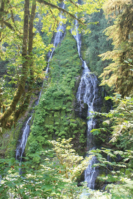
We examined the geology of the bedrock, the plants and gnarly tree roots and exchanged convivial chatter and before we knew it, standing before us was the unnamed forked waterfall was rushing over the precipice on the other side of Boulder River. |
| Embraced within the folds of a massive cedar tree on the Boulder River Trail |
 |
| Sue and Mark share roots |
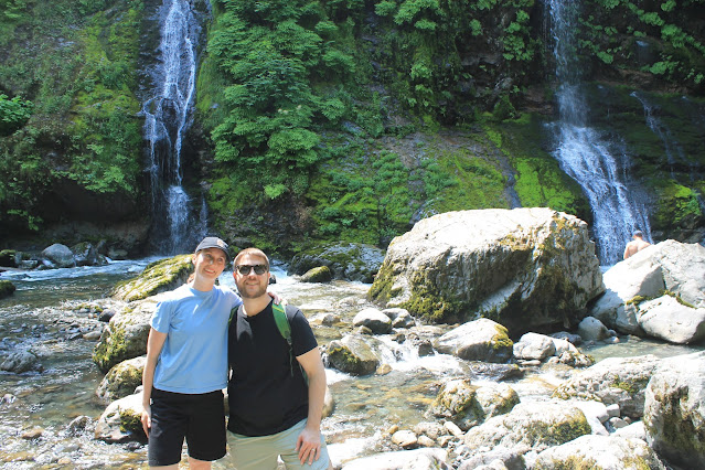
Rounding the trail that followed the contour of the steep slope, the waterfall (which I feel should be named 'Dragon Tongue Falls') came into view. We all scrambled off the trail and down the rough slope to walk and hop among the boulders of Boulder Creek at the base of the falls. |
| Kaileen & Grant at trail's end for Dragon Tongue Falls |
***We hiked back to our cars at the trailhead where we discuss our plans. It was decided to grab some lunch at the Burger Barn in the small town of Darrington a few miles further up the road.
After lunch, "Anyone interested in another waterfall?"
I explained it was a rather short hike to see North Fork Sauk River Waterfall, a full-blast, roaring waterfall, in contrast to the flittering, tranquil essence of our morning's first waterfall experience. In answer to my question, it was a resounding, "Yes!"
We traveled in tandem over about 16 miles of unpaved seasonal road know as The Mountain Loop Highway.
The springtide flood and volume made for a spectacular sight.
 |
| The roaring North Fork Sauk River Falls |
 |
| Sue silhouetted against the backdrop of an impressive waterfall |
Grant and Greg managed to scramble over the rocky, semi-blazed trail to stand on the bedrock at the base of the falls. Kaileen, being the social media poster extraordinaire, got some great shots of the place to post to her friends and adventure followers.
***
It was mid-afternoon, and I had a suggestion. Since we've come this far, how about we finish this Mountain Loop of a so-called highway, and go see a series of waterfalls cascading into an avalanche shoot piled high with the winter's snow where the water carves out an ice cave at the base of Big 4 Mountain?
Wheeling over the pothole pocked dirt road that is the Mountain Loop Highway, we crossed over Barlow Pass, leaving the Sauk River watershed and descended into the Stillaguamish River watershed and some spectacular views of some of the peaks of the Cascade Range. We parked at the Big 4 Mountain lot where once stood a grand hotel, until it burned to the ground in 1938.
Walking along the path to the trailhead, a busy beaver was spotted hauling a 3-inch diameter piece of wood and paddling through the one of its beaver mash waterways.
 |
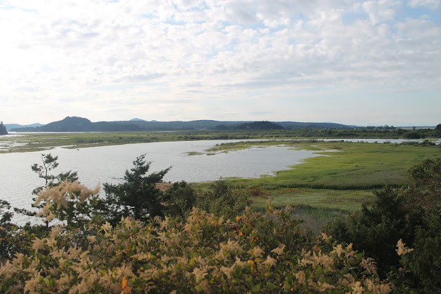
| Beaver viewing from a boardwalk above the marsh at Big 4 Mountain |
It was enjoyable hike through marsh, across an aluminum bridge and into the woods where several redheaded woodpeckers were spotted. We were warned by signs not to enter the ice caves as there were at least four different ways in which one could die; killed by falling rocks, killed by collapsing ice, killed by falling through an ice crevasse, or killed by an avalanche.
At the end of the trail, we viewed the ice caves beginning to form at this early stage of the seasonal melt, from a safe distance. I was tempted to challenge fate and get closer, as I think was Grant, but in deference to our wives, we held back our adventurous exploration.
 |
| A stern warning from the US Forest Service |
 |
| Sue with avalanche chute and waterfall at Big 4 Mtn |
With a good day's worth of waterfalls collected in our minds, we passed through Granite Falls and headed back home. We called in an order for some Greek-style pizza for pickup on our way home.
We estimated (using their cell phone tracking) that we hiked between 7 and 8.5* miles in our treks to see Pacific Northwest waterfalls.
*Different devices had different estimates.
We kicked off our boots, devoured our pizza dinosaur-time style and opened a few brews in the long-lasting evening light of this latitude.
"What do ya got for us tomorrow, Mark?" Someone asked.
"We've done mountains today, let's do sea and saltwater and The Islands tomorrow. We'll take it easy, relax on a ferry boat ride to San Juan Island and Friday Harbor."
Sounds good. See ya in the morning. Goodnight.


.jpg)


